Old maps of the Simbirsk province. Maps of the Simbirsk province Old maps of the Simbirsk province by Schubert
Maps of Simbirsk province
| Name | Example | Sat list | Download | |||
| Economic note to the PGM of the Kurmysh district | 1790 | 751.3mb | ||||
| PGM Karsun district | 2v | 1807 | 66.1mb | |||
| PGM Kurmysh county | 2v | 1808 | 32.7mb | |||
| PGM Simbirsk district | 2c | 1808 | 44.5mb | |||
| PGM Sengeleevsky district | 2c | 1808 | 38.9mb | |||
| PGM Alatyrsky district | 2c | 1809 | 46.7mb | |||
| PGM Ardatovsky district | 2v | 1805 | 38.1mb | |||
| PGM Buinsky district | 2c | 1808 | 40.4mb | |||
| PGM Stavropol district | 2c | 1809 | 66.5mb | |||
| PGM Syzran district | 2c | 1806 | 54.8mb | |||
| Plan of the environs of the city of Simbmirsk | 3c | 1912 | 24.3mb | |||
| Pilot map of the river. Volga (from the Kama reach to Tsaritsin) | 500s | 1913 | ||||
| Map of the Red Army Ulyanovsk 5-N-39 | 3km | 1949 | 44.3mb | |||
| Mende Map | 1c | 1860 | 892.7mb | |||
| Inundation zone map
Kuibyshev reservoir |
2km | 1940 | 14.3mb | |||
| Lists of populated places | 1863 | 241.4mb | ||||
| ACR Simbirsk province (with a map) | 1900 | 4.7mb | ||||
| Book G. Peretyatkovich. "Volga region in 17-18 centuries" | 1882 | 0.7mb | ||||
|
Cap book. Nevostruev. "On the settlements of the ancient Volga-Bulgarian and Kazan kingdoms" |
1871 | 1.4mb |
Maps available for free download
Maps are not available for free download, about getting maps - write to mail or ICQ
Historical information on the province
Simbirsk province- an administrative-territorial formation with a center in Simbirsk, formed from the Simbirsk governorship in 1796. In 1924 it was renamed Ulnovskaya province. It was abolished in 1928 during the economic zoning of the USSR. On January 19, 1943, the Ulyanovsk region was formed on a part of the territory of the former Simbirsk province.
Population
According to the All-Russian census of the Russian Empire in 1897, 1,549,461 people (749,801 men and 799,660 women) lived on the territory of the Simbirsk province. Of these, 109,175 were urban residents.
Social and national composition
According to the survey of the province for 1898, there were: hereditary nobles - 3439, personal - 2971, white clergy - 7551, monastics - 718 (104 men and 614 women), honorary citizens - 2789, merchants - 1969, bourgeois - 64 339, peasants - 1,190,749 regular troops - 2,507; retired and permanent lower ranks, their wives and daughters - 207,836; colonists - 563; foreigners - 106,476; in addition to Russians (among them there were a few Little Russians, in the Syzran district), the province was inhabited by Mordovians (Erzya and Moksha), Tatars, Meshcheryaks, Chuvashs. The Russians entered the province when the Chuvash, Mordovians and Tatars already lived here.
Administrative device
In 1796, the province was divided into 10 counties: Alatyrsky, Ardatovsky, Buinsky, Karsunsky, Kurmyshsky, Samara, Sengileevsky, Stavropol, Syzransky and Simbirsky. The following year, the Insar, Saransk and Sheshkeevsky counties were transferred from the abolished Penza province (returned in 1801). In 1798, three uyezds were abolished: Ardatovsky, Sengileevsky, and Sheshkeevsky (the first two were restored in 1802).
After two Trans-Volga counties (Stavropol and Samara) joined the Samara province in 1850, until the collapse of the Russian Empire, the Simbirsk province consisted of 8 counties:
Simbirsky,
Sengileevsky,
Syzran,
Buinsky,
Karsunsky,
Kurmysh,
Alatyrsky,
Ardatovsky.
There were 39 deanery districts; settlements - 1641, including 8 cities, 550 villages, 119 villages, 967 villages and 12 settlements. According to the estimates of the provincial zemstvo for 1897, 218,863 rubles were assigned for mandatory expenses, 229,037 rubles for optional expenses, including 28,860 rubles for the maintenance of the council. Income was calculated at 437,893 rubles. The zemstvo had an emerital cash desk (by January 1, 1898, it had 112,301 rubles). By January 1, 1898, the provincial zemstvos had 1,266,705 rubles of all capital.
In 1920, the Kurmysh district went to the Chuvash Autonomous Okrug, and Buinsky - to the Tatar Autonomous Soviet Socialist Republic. After 4 years, the Sengileevsky district was abolished.
In 1928, the province and all its counties were abolished, and their territory became part of the Middle Volga region.
* All materials presented for download on the site are obtained from the Internet, therefore the author is not responsible for errors or inaccuracies that may be found in the published materials. If you are the copyright holder of any submitted material and do not want a link to it to be in our catalog, please contact us and we will immediately remove it.
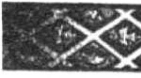
Large card size: 90 x 63 cm. Consists of 30 sheets glued to fabric. Rarity. The map is very detailed - brick sheds, foresters' houses and gatehouses, guardhouses, bees, etc. are marked.
Large (from 30 sheets glued to the fabric),
Genuine old geographical map
End of XIX century. Very detailed.
Rarity!
Simbirsk province
(West Side)
Ulyanovsk region
Cartographer Alexander Ivanovich Mende(Mendt, 1800 - 1868).
The outstanding Russian cartographer Lieutenant-General A.I. Mende for a little over
For a decade and a half (in 1849-1866) he completed cartographic topographic
Filming, which eventually covered the territory of Central Russia (provinces
Vladimir, Nizhny Novgorod, Ryazan, etc.) with a total area
345,000 sq. verst. The materials of his expedition were based on
These are magnificent color topographic maps to scale.
There are 1 verst in 1 inch or 420 m in 1 cm; and in 1 inch 2 versts
Or in 1 cm 840 m, on which both latitudes and longitudes are indicated.
In this region, Mende covered part of the territory of the current
Ulyanovsk and Samara regions, as well as Chuvash
Republic. Topographic survey was carried out
From 1859 to 1861.
The map is very detailed, brick sheds are marked,
Foresters' houses and gatehouses, guardhouses,
Bees, barnyards, springs, etc.
Simbirsk province- an administrative-territorial unit of the Russian Empire and the RSFSR, which existed in 1796 - 1928. Provincial city - Simbirsk. By the beginning of the 20th century, the Simbirsk province occupied 49.5 thousand km² (43,491 versts²). It bordered on the Kazan province in the north, on the Volga in the east, separating it from the Samara province (covering the left bank of the Volga only in two places: opposite Simbirsk and in Syzran), in the south - on Saratov, in the west - on Penza and Nizhny Novgorod provinces. In 1926, the area of the province was 34,071 km². The territory of the province has been inhabited since very ancient times. The first more definitive information about it is found among Arab writers, some of whom were here personally in the 10th century, when the Baghdad Caliphate established diplomatic relations with the Bulgars. According to these sources, the Burtases lived in the southern part of the province, and Mordovians lived along the banks of the Volga, especially to the north of the place where Simbirsk was located. In the XIII century, the Tatars appeared in the region. In the XIV century, with the strengthening of the princes of Nizhny Novgorod, they extended their power in the Mordovian land to the upper reaches of the Sura, which served as a border from the side of the Horde possessions. However, at this time, apart from the city of Kurmysh and, perhaps, a few secluded farms or outposts, the Nizhny Novgorod princes did not arrange anything here. In all likelihood, Russian colonization did not extend here further than the Alatyr River. It did not exist on the right bank of the Sura until the last quarter of the 16th century, from the end of which the settlement of Russians within the current Simbirsk province becomes more noticeable. Even under Tsar Ivan the Terrible, the city of Alatyr arose, then many settlements in the counties of Syzran and Sengileevsky. Guards were set up to protect against attack by freemen and hoards, which always held out on the Volga, but at the end of the 16th century were especially strengthened due to the assignment of peasants to landlords. In 1648, Simbirsk was founded and a defensive line was built to the south-west from an earthen rampart with a moat and a wooden fence, and in some places with notches, towers and prisons. She went further, to the Penza province; its remnants were quite significant even by the end of the 19th century. The former fortified fortresses existed at that time under the name of suburbs and villages. Simbirsk Governorate was abolished in 1928 during the economic zoning of the USSR. On January 19, 1943, the Ulyanovsk region was formed on a part of the territory of the former Simbirsk province.
Big card size: ~ 90 x 63 cm
Consists of 30 sheets glued to the fabric.
Clean back.

FOR FULL SCREEN VIEW CLICK ON THE PHOTO
Alatyr- a city in Russia, the administrative center of the Alatyrsky municipal district of Chuvashia (which is not included). The city is located in the Middle Volga region, on the left bank of the Sura River, near the confluence of the Alatyr tributary. The territory of the city is 41.7 km². The official date of the founding of the city is 1552 - the time of the first mention of Alatyr in the Patriarchal (Nikon) chronicle: “And the sovereign taught to think with his brother, with Prince Vladimir Andreevich and with the boyars and with all the governors, how to go to Kazan and to which places; and the sovereign ordered to go in two, accommodation for people, and the sovereign himself to go to Volodimer and Mur, and let the governor go to Rezan and Meshchera, and the descendant to the Field behind Alatar. This text is one of the fragments of the description of the last (third) campaign of Ivan IV against Kazan, which ended with the conquest of the Kazan Khanate. The mention of Alatyr on a par with other cities allowed historians to suggest that by that time the city already existed. In particular, in the “Geographical Lexicon” by F. A. Polunin, information is provided indicating that Alatyr was founded back in the 13th century, during the reign of Yuri Vsevolodovich of Vladimir, as a prison on the site of a Mordovian village, which was transferred by John IV in the 16th century to a new, more convenient place for the fortress. Disagreement among historians is also caused by when, in reality, the Russian army, led by the tsar, passed through the territory of the present city. So, one of the researchers in the history of the Surye, V. M. Shishkin, believes that Alatyr could have been founded by Ivan Vasilyevich during not the last, but also the 1st Kazan campaign (that is, in 1547-1548). Unconditional and indisputable is only the fact that the settlement on the site of the modern city existed long before it was mentioned in Russian chronicles. This is confirmed by the found remains of an ancient settlement (presumably belonging to one of the Mordovian tribes), and archaeological finds (including the 10th-12th centuries), and the name of the Erzya settlement Sandulei (Erz. Syangley, “Fork in the river”) preserved in the toponymy of Alatyr.

Karsun- a working settlement in the Ulyanovsk region of Russia. The administrative center of the Karsun region. Karsun, formerly a city, currently an urban-type settlement, is located on a high hilly bank of the Barysh River, at the confluence of the Karsunka River with it. A flat area was formed along the watershed of the Barysh River and its tributaries, convenient for overland movement to the east through the Tagai and Tetyushskoye to the Volga crossing in the Simbirsk region: to the northwest to the Sura crossing in the Promzino region and to the southeast to the Sura crossing in the Penza region, and then to Kyiv and in the same direction with a turn to Ryazan towards Moscow. An ancient caravan route from Bolgar to Kyiv passed through these places, and one of the sites was located in the area of modern Karsun. On the map of the Kazan Khanate during the campaigns of Ivan the Terrible, there is the first documentary mention of Korsun as an aul of the Kazan Khanate and, in fact, a stopping point on a large caravan route. 1647 is the time when Bogdan Khitrovo, sent here by Alexei Mikhailovich, created a fortified outpost of the Russian state on the new southern borders to protect against nomadic tribes (this date is considered the year the settlement was founded). Obviously, he left the names of the new fortresses - Karsun and Simbirsk - after the settlements that already existed.

Tatar Abyss- a village, part of the Bolsheaksinsky rural settlement of the Drozhzhanovsky district of Tatarstan. Tatarskaya Abyss is one of the oldest settlements in Tatarstan with a 1000-year history. Near the village there is a Tataro-bezdninsky settlement with two barrows. Four versts from the Chuvash village of Bezdny, in a field and not far from the forest, between the rivers Bezdnoyu and Mazare-Syurmi, there is a town of a quadrangular shape, dug in by a rampart with a moat, having two exits. The length of the town is 70 fathoms, the width is 50 fathoms. A gun and various iron things were found in it. Between the towns of the villages of the Russian Abyss and the Chuvash Abyss, in the fields there are mounds of earth in the form of mounds, which are called Nogai graves. Near the village Russian Abyss there is a town dug in by a quadrangular rampart with a moat. The town has an exit to the west. According to legend, a prince lived there. Chuvash Abyss- a village, included in the Bolsheaksinsky rural settlement of the Drozhzhanovsky district of Tatarstan, located 2 kilometers from the Tatar Abyss (in the southwest of the Drozhzhanovsky district). 12 km away from the regional center. There is a school, which was founded in 1892 as a zemstvo school. The place for the village was chosen because the river Abyss originates here. The population is predominantly Chuvash. Burials and household items were found on the territory of the Chuvashskaya Abyss village, which indicates that people lived in this territory already in the period of the early Bulgars. Abyss River- the right tributary of the Sura (Volga basin). It flows within the Shemurshinsky and Alatyrsky regions of Chuvashia, flows into the Sura near the city of Alatyr. A significant part of the current passes through the Chavash Varmane National Park. Source near the village of Chuvashskaya Bezdna, Drozhzhanovsky district, Republic of Tatarstan. The length of the river is 106 km.

Leaning- the village of Karsunsky district of the Ulyanovsk region, located 32 km northeast of the district center on the Maly Uren River. The village of Prislonikha was founded in 1672 near the Kamenny Brod River, later called Maly Uren. In the order chamber of Simbirsk, the refusal books indicate that “in 1672, Ivan Baksheev, a Sinbirian, allotted local lands to Reiter Stepan Maksimov 30 couples, Reiter Afanasy Slapoguzov and his comrades, nine people, and an elected regiment to soldiers Grishka Repin with comrades, ten people, 30 each. to everyone in the Sinbirsk district, behind the rampart, up the Uren, along the Kamensky Brod river, along the Vasilyeva side of Yazykov and the soldier's side of Larion Sokin, the village of Belago Klyucha. Simbirsk historian P.L. Martynov believes that the founder of the village was Martin Grigoryevich Boltachevsky, after him the village was owned by his grandson, Semyon Ivanovich Boltachevaky. Initially, the village was called Bogoyavlenskoye, after the name of the first church "in the name of the Epiphany of the Lord." According to the documents of 1694, the village had the name "Bogoyavlenskoye, Kamenny Brod, too" after the name of the church and the river. The modern name of the village Prislonikha appeared at the end of the 18th century. The fact is that the village, located at the foot of low hills (ridges), seemed to “lean” against them.
Tagay- a village (formerly a city) in the Mainsky district of the Ulyanovsk region of Russia. Tagay was founded in the middle of the 17th century as a fortification as part of the Simbirsk line, in 1780 it received the status of a county town, in 1796 it became a provincial town, now a village.

The provincial town of Kotyakov (mid-17th century - 1780 the village of Kotyakovo, 1780 - 1796 the city of Kotyakov, 1796 to the present - the village of Kotyakovo) - a village in the Gorensky rural settlement of the Karsunsky district of the Ulyanovsk region (the former Gorinsky volost of the Karsunsky district of the Simbirsk province) . It is located on the right bank of the Sura River, at the mouth of the Gorenka River, 22 km northwest of Karsun and 119 km west of Ulyanovsk (along the highway). The village has been known since the 17th century. On September 15, 1780, by decree of Catherine II, the village was transformed into the county town of Kotyakov of the Simbirsk governorate. In 1796, the Kotyakovsky district was abolished, and the city again became a village. According to legend, the settlement was founded by a native of the village of Naletovo (now the village of Nalitovo, Inza district) Mordvin Kotyak, even before the construction of the Simbirsko-Karsunskaya notch line in the middle of the 17th century and the mass colonization of the region. The Razin rebellion of Kotyakovo is mentioned in documents relating to the Cossack-peasant war of 1670-1671 led by Stepan Razin. In early September 1670, while at the walls of Simbirsk, Razin sent special Cossack detachments - "beaters" to the inhabitants of the region with calls to join his army. After the defeat of the Razintsy near Simbirsk, the voivode Baryatinsky moved along the Simbirsk-Karsun line. On November 12 and 18, he defeated the rebels near Ust-Uren. The surviving Razintsy scattered around the surroundings, went into the forests and made notches and fortresses with log walls, ramparts and ditches. Prince Yuri Baryatinsky stopped with the whole army in Kotyakovo and here in the winter of 1670-1671 he carried out reprisals against the captured Razintsy. “The frightened rebels then began to resign themselves and sent deputations to Kotyakov with an expression of humility and promises that they would not stick to any thieves' charms in advance. Baryatinsky, content with their oaths, soon afterwards set out from Kotyakov to Alatyr. Shortly after these events, in 1671, the parishioners built the first church in Kotyakovo in the name of the Archangel Michael. By decree of Empress Catherine II of September 15, 1780, the village of Kotyakovo turned into the city of Kotyakov - the center of the Kotyakovsky district of the Simbirsk governorship. The following were opened in the city: "public offices: the County Court, the Noble Guardianship, the City Council, the Lower Zemsky Court and the County Treasury." The county consisted of 89 villages and villages with a population of 60 thousand people. There were two distilleries and 40 mills. The emblem of Kotyakov was approved on December 22, 1780, along with other emblems of the cities of the Simbirsk governorate. It is a blue field shield, divided by a longitudinal line into two parts. At the top is the coat of arms of Simbirsk (a column topped with an imperial crown), at the bottom - "three green mountains in a blue field, which in fact are in fact near this city."

Nikitino- A village in the Ulyanovsk region, the administrative center of the Nikitinsky rural settlement. It is located 120 km northwest of Ulyanovsk. "Wild field", so in the days of "hoary" antiquity they called these places. The impenetrable taiga stretched for hundreds of kilometers. She aroused horror and admiration among people who dared to populate this land. But people have always been attracted to these places. This is evidenced, for example, found in p. Nikitino hoard of Golden Horde coins of the XIII century. This proves that already in the XIII century people lived here. And the places were really marvelous: the abundance of forests that provided building materials, food, furs; the river Barysh is navigable and rich in fish; the Chechora River - then still a spring; land that is not fertile, but yields a good harvest. The time of the emergence of the village of Nikitino falls on the second half of the 17th century - then, as a result of the victories of the Moscow Tsar Ivan IV "the Terrible" over Kazan, the colonization of the region by Russian people begins. Fugitive peasants began to appear in these places from central Russia, who gave birth to s. Nikitino and nearby villages. Land in the village Nikitino belonged to the count, the landowner Guryev. The origin of the name of the village is beyond doubt that it is truly Russian. It is possible that the village was named after its founder-leader. It was the leader of the gang of runaway peasants, whose name was Nikita. In this case, the expression "Nikitkino village" is attached. During the years of the peasant uprising (1670) under the leadership of Stepan Razin, the Nikitin peasants did not stand aside from active actions. The village and the events of the peasant war under the leadership of Emelyan Pugachev (XVIII) did not bypass. In the 20s of the XIX century, the serfs of a number of villages and villages of the Alatyr district expressed dissatisfaction with their difficult situation. So, in 1824, unrest occurred in the village of Nikitino: the peasants refused to pay dues to local landowners. Dissatisfied peasants gathered in detachments, but were dispersed with the help of military force. Events 1905-1907 the Simbirsk Territory, including the villages of the Alatyrsky district, were not bypassed. The village was large, consisted of 700 households, 7 streets. The primary school was opened in the second half of the 60s of the XIX century with the help of the Simbirsk educator I.N. Ulyanova(Ilya Nikolaevich Ulyanov (1831, Astrakhan - 1886, Simbirsk) - statesman, teacher, supporter of universal education equal for all nationalities. Active state councilor. Ilya Ulyanov was famous for his famous revolutionary sons - Alexander Ulyanov and Vladimir Ulyanov-Lenin.) . Initially, the school was in a wooden building, not far from the church (not preserved), in the late 1980s a new two-story brick school building was built in the village. One of the first owners of the village was Count D.A. Guriev, whose name is the famous Guryev porridge(porridge made from semolina in milk with the addition of nuts (hazelnuts, walnuts, almonds), kaimak (cream foam), dried fruits. It is considered a traditional dish of Russian cuisine, but was invented only at the beginning of the 19th century. The name of the porridge comes from the name of Count Dmitry Guryev, Minister of Finance and member of the State Council of the Russian Empire. It was invented by Zakhar Kuzmin, the serf cook of the retired major of the Orenburg Dragoon Regiment Georgy Yurisovsky, with whom Guryev was visiting. Subsequently, Guryev bought Kuzmin and his family and made him the staff chef of his court. According to another version, Guryev himself came up with a recipe for porridge, which was the favorite dish on the menu of Emperor Alexander III.)
Vypolzovo- a village in the Sursky district of the Ulyanovsk region as part of the Nikitinsky rural settlement, near the river Barysh. The village was founded in 1670 by the Utinsky nobles on the lands received for the sovereign service. The former name of the village was Blagoveshchenskoye, located in the flood zone of the Barysh River. Every year during the spring flood, the river flooded the village. Residents, seeing the inconvenience of such an arrangement, began to build up higher plots, and gradually the houses seemed to “crawl out” onto the hill. It was then that the name Vypolzovo was assigned to the village. Before the abolition of serfdom, the village was a landowner's village, it was famous for its woodworking, leather crafts, as well as the production of hats - felted hats. In Vypolzov, several landowner families stood out. The family of the landowner Krynin had his own Cheska. Two daughters - Sophia and Valentina - taught children at school. After the revolution, a school and a bakery were opened in the Krynins' house. The Vasechkin family had large land shares, which were engaged in growing grain and raising livestock. In 1893 a wooden church was built, and a parochial school was opened with it. In 1905, a wave of peasant riots swept across Russia. In the village, the estates of the landowners Myatlev and Nikolaeva were destroyed. In 1913, there were 187 households and 1081 inhabitants in the village. In 1930, the Krasny Kustar collective farm was organized in the village.
nod- a village in the Nikitinsky rural settlement of the Sursky district of the Ulyanovsk region of Russia. The village is located on the left bank of the Barysh River at the confluence of its left tributary - the Kivatka River. The center of the settlement - the village of Nikitino - is 5 kilometers away. Nodding appeared no later than the 17th century, it got its name from the Kivatka River. Kivatka comes from the Mordovian kev (stone) and vad (water) and corresponds to the Russian toponym "Kamenka" (a river with a rocky bed). It is mentioned in documents of the 17th century as Kivatskaya or Kivatskaya Sloboda. According to the descriptions of the steward Ivan Velyaminov, made in 1685-1687, in Kivati at that time there was a wooden church of the Most Pure Mother of God of Vladimir. In 1696, the serving Cossacks were transferred together with their families from the settlement to the city of Azov, and the settlement was given to the estate of the stolnik Fedor Fedorovich Pleshcheev, who settled in it 25 households of his peasants, transferred from the village of Chebaryapa and the village of Cherlenova Alatyrsky district. In 1780, the settlement was transferred from Sinbirsky to Kotyakovsky district. In 1898, the village was listed in the Ust-Urensky volost of the Korsun district; it had a school and a church. In 1918-1954, the village was the center of the Kivat village council, which moved from region to region several times. In 1954, the village council was merged with the Nikitinsky village council. In 2003, it was in the Vypolzovsky village council. In 2004, it was transferred to the Nikitinsky rural settlement.

The photo shows the approximate boundaries of the map:

Note: OLDGRAVURA logo on the photos
Posted to protect the rights to the image, on
The engravings you purchase do not have the logo.
You are buying a genuine vintage
Map (not a copy or a reprint).
The card will serve as a good gift
Boss, partner, collector of prints and antiques,
Decorate the office, living room, country house
And the office will become an interesting exhibit of the museum.
During the administrative reform of Peter the Great in 1708, when the lands of the future Russian Empire were divided into provinces, the territory of the future Simbirsk province (in particular, the Simbirsk district) was included in the vast Kazan province (one of the eight new provinces). In 1719, the Simbirsk district was withdrawn from the Kazan province and included in the Astrakhan province, formed two years earlier. Under Anna Ioannovna in 1737, the Simbirsk province (with the administrative center in Simbirsk) was formed as part of the Kazan province, which existed until the abolition of the division of provinces into provinces in 1775. In 1780, as a result of the territorial transformations of Catherine II, Simbirsk governorship of thirteen counties (Alatyr, Ardatovsky, Buinsky, etc.) ... (continued below)
Buy rare digital copies of maps of the Simbirsk province >>>
In the Simbirsk province, in whole or in part
There are the following maps and sources:
(with the exception of those indicated on the main page of general
All-Russian atlases, in which this province can also be)
 1st and 2nd layout Mende 1850s
A one- or two-layout map of Mende is a topographic map (latitudes and longitudes are indicated on it), a hand-drawn map of the mid-second half of the 19th century. (after the next changes in the borders of the provinces of Russia in 1802-03), very detailed - on a scale of 1 inch 1 verst or in 1 cm 420 m and in 1 inch 2 versts or in 1 cm 840 m. The purpose of the Mende map is to indicate the boundaries of private land holdings (so-called dachas) within the county.
Note: We have at our disposal a digital copy of the Mende maps of the Simbirsk province in 300 dpi resolution.
Download the Mende map of the Simbirsk province of 1850 1inch=2 versts >>>
 1st and 2nd layout of land surveying in 1796-1806.
Survey maps - hand-drawn map of the late 18th - early 19th centuries, very detailed - on a scale of 1 inch 1 verst or in 1 cm 420 m or scale 1d=2v. A separate county was drawn in fragments, on several sheets, shown on a single composite sheet. The purpose of the survey map is to indicate the boundaries of private land holdings (so-called dachas) within the county.
Note: We have at our disposal an unstamped digital copy of the survey maps of the Simbirsk province in 300 dpi resolution.
 Lists of populated places in the Simbirsk province of 1863 (according to information from 1859)
This is a universal reference book containing the following information:
- the status of the settlement (village, village, village - owner or state, i.e. state);
- location of the settlement (in relation to the nearest road, river or river);
- the number of households in the settlement and its population (men and women according to 1858 data);
- distance from the county town and camp apartment (centre of camp);
- the presence of a church, a chapel, a mill, fairs, etc.
Download lists of settlements in the Simbirsk province in 1863 >>>
 economic notes to the General Land Survey of the Simbirsk province
In the Kurmysh district of the Simbirsk province, it should be noted that the ES (economic notes) are very thick with detailed painting of lands and rivers.
Under Paul the First in 1796, as a result of the reverse transformation of the Russian viceroyalties into provinces, the Simbirsk viceroyalty was transformed into the province of the same name with the abolition of some uyezds of the former viceroyalty (Kotyakovsky, Kanadeisky) and consolidation of other counties at the expense of their lands (for example, at the expense of the lands of the Kotyakovsky district the counties of Karsunsky, Alatyrsky were enlarged), with a total of ten counties. In 1797, in connection with the abolition of the Penza province, the former Penza counties Insarsky, Saransky (later enlarged at the expense of the lands of the former Kotyakovsky county) and Sheshkeevsky were transferred to the Simbirsk province. In 1798, Ardatovsky, Sengileevsky (Singileevsky) and Sheshkeevsky counties were abolished within the borders of the Simbirsk province. The next changes in the borders and composition of the counties of the Simbirsk province took place in the reign of Alexander the First in 1801, when the Ardatovsky and Sengileevsky counties were restored and the Tagai county was abolished. In 1802, the Sheshkeevsky district was restored and, along with the Insar and Saransky districts that previously belonged to the Penza province, was withdrawn from the Simbirsk province and transferred to the newly formed Penza province. The last changes in the administrative boundaries of the Simbirsk province and the composition of its districts of the pre-revolutionary period date back to the reign of Nicholas I, when in 1850 the Samara province was formed and the Volga districts of the Simbirsk province - Stavropol and Samara - were transferred to its composition.
Read also...
- Maps of the Simbirsk province Old maps of the Simbirsk province by Schubert
- We clean coins at home: with soap, Coca-Cola, citric acid, electrolysis method
- Detailed map of the Oryol region with villages, cities, towns and districts Schubert's map of the Oryol province 1850
- What are the signs advised to do if you find a cross