Terrain orientation methods. How to correctly navigate the terrain using a compass - practical advice. Orientation using the map
Sometimes, while in the wild, it is necessary to have skills such as orientation in space. When you urgently need to determine the cardinal points relative to yourself, knowledge will come to the rescue to be able to navigate in the forest without a map and a compass, or only if you have a compass. This is what will be discussed.
How to navigate without a map
Being in the forest without a map, do not rush to panic, there are:
By compass
Approaching the forest, turn your face in the direction where you are going to go. Take the compass, and, keeping it strictly horizontal, turn it so that the letter N on the dial is shifted to the north end of the compass arrow. Keeping this alignment strict (a fundamental requirement when using a compass), see which number on the dial of the compass is on the side you are going to go. If it shows 60, it means the bearing is 60. Bearing is the direction in degrees. The azimuth is determined if the direction has already been determined visually. Suitable in cases where it is necessary to control the straightness of the movement in the direction.
Orientation by heavenly bodies
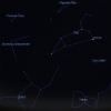
- Stars. To navigate by the stars, you need to find the Big Dipper's bucket. It consists of 7 bright stars. Mentally connect the 2 extreme stars, on the continuation of the line passing between them, set aside five of the same segments. You will see the polar star. It is located above the north side of the horizon. You can also see the topic.
- The sun. If you face the rising sun, the left will be north right south. With the help of shadows. Find a twig about a meter long and stick it vertically into the ground. Mark the tip of the shadow every 15 minutes. The shortest shadow indicates the midday line, that is, north or south. Determination of directions to the sides of the horizon by compass, celestial bodies, signs of local objects. Another way to orient yourself by a celestial body is, read more in our article.
Orientation without a map
There are many natural landmarks in nature. All of them are inaccurate, like celestial bodies, if you find several clues at the same time, then the chance of accuracy increases. Let's take a look at some of the tips.
- Moss. Moss does not like direct sunlight, warm places and is located in the northern part of the trees. It is important not to make a mistake in a dense forest where there is little light, moss grows on all sides of the trees. If it grows around a tree, it is not The best way orientation. If the moss grows on multiple trees on one side, it will be north.
- Tree branches. The longest branch of the tree will point to the warmest and sunniest side - south. Crown of trees. Long branches to one side, short branches to the other. The short ones point north. If you look at a tree near the clearing, all the trees will stretch in long branches towards the clearing. If all the trees in a dense forest point in one direction, this is the south.
- Anthill. Pay attention to its sides, they will be different in steepness. The short side of the anthill is directed towards the cold side of the forest (north), long and gently sloping towards the sunny (south). You can read more about how to navigate the anthill on our website.

Anthill
It is important to understand why you need to understand which side of you is north or south. If you are sure that there is a settlement, a railway or a river to the north of the forest, then knowledge will help you get to them.
If you absolutely do not know where you are, it is better to stay overnight, build a shelter and make a fire.
A few simple rules to avoid getting lost
- Warn loved ones where you are going before hiking the forest.
- Dress brightly so that you can be clearly seen against the green forest background.
- Carry a phone, knife, matches, compass or watch with you. Take a well-charged phone battery.
- If someone close to you does not get in touch for a long time, urgently call the rescue service.

If you get lost. Calm down first, panic will make the situation worse. Try to remember the largest and most remarkable objects to which there is a high probability of getting out of the forest. Determine the side of the world according to the signs described in the article, and go in the direction in which the desired object should be located.
If you come out to the railway, river or path, then they will certainly lead you to the village. If it is a river, you need to move with the flow. If you don't know the area, try climbing a tall tree. Remember to be careful. From a height it is possible to see various objects such as towers.
So, once again, briefly. If you get lost, don't panic. If you are sure that they are looking for you, stay put. It is not only your behavior that matters, but also what you are wearing. Trousers must be tucked into shoes. The jacket should be with elastic on the sleeves and at the body. Clothes should be tight.
How to navigate the forest if you don't have a compass with you? This question interests many mushroom pickers, hunters and gatherers of berries. After all, everyone can get lost in even a small forest. What are the criteria for determining the sides of the horizon? There are various ways to orient yourself without using special devices. We will consider them in the article.
By the sun
How to navigate the forest by the sun? This method can be used only in clear weather. There are several methods for determining the cardinal points.
The sun always rises from the east and sets from the west. In the middle of the day, it is located in the south (in the northern part of the globe). If you get lost in the forest of the Southern Hemisphere, then at noon the sun will be from the north.

How can you navigate the forest with a watch in sunny weather? The following method will help you determine the north side:
- You need to stand in such a way that the hour hand is facing the sun.
- Mentally, you need to draw the angle between the hour hand and the mark "13" (or "1") on the dial. Then it must be visually divided in half by a straight line (bisector).
- Until 13:00, north will be to the left of the sun, and after that - to the right. In the Southern Hemisphere, the north will be exactly the opposite.
If you can find a stick in the forest, you can try making a gnomon pole. However, you can navigate with it only at noon. The stick must be dug into the ground. Around noon, the shadow of the pole will point north. For accurate orientation, you need to choose a stick that is long enough.
By plants
How to navigate the forest without a compass on a cloudy day? After all, it is possible to determine the sides of the horizon by the sun only in cloudless weather. In this case, you need to look closely at the trees. They will help you to find your way following signs:
- You will notice that one side of the bark is darker in color and the other is lighter. This feature is most pronounced in conifers. The dark crust is on the north side. Its color is due to less exposure to sunlight.
- It is also necessary to reverse the peeling to the resin of conifers. Its greatest emphasis is observed on the southern side. And the growth of mosses, lichens and fungi on the bark is more often observed in the northern part.

In the summertime, you can take a closer look at the color of the berries. They usually ripen faster on the south side. And the part of the berries that faces north has a greenish color.
By animals
How to navigate the forest by observing the behavior of animals? At certain times of the year, the sides of the horizon can be identified by migratory birds. In the fall, their flocks fly towards the south, and in the spring - to the north.
If you find an anthill, then with its help you can navigate. You need to pay attention to its shape. In the northern part, the anthill has a steeper slope, and in the southern part it is gentle.

In summer, it is also useful to look closely at butterflies. It is necessary to monitor the behavior of these insects during rest. When a butterfly lands on a flower, it keeps its wings in a folded position. Thus, she tries to protect them from the sun. In the morning, the folded wings face the east, during the day - to the south, and in the evening - to the west.

Through forest glades
Consider orienteering in the forest along clearings. Today, many large green areas are divided into neighborhoods. Paths - glades are organized between these squares. They are cut in the north-south or west-east direction. At the intersection of these paths, special pillars are installed, which can serve as a fairly reliable reference point.
These posts represent four-sided logs driven into the ground. On each face there are numbers that indicate the quarter number. You need to take a closer look at them. You need to find two faces with smallest values digits. The edge of the pillar between them always faces north.
At night
How to navigate the forest at night? It is not recommended to actively move in the dark. There is a high risk of injury or attack by wild animals. It is better to wait out the night by the fire. However, if you need to get out of the forest after sunset, you can try to orient yourself by the stars.
You need to find the constellation Ursa Major in the night sky. It looks like a bucket. On the territory of Russia, this constellation can be seen in any season. Its two extreme stars (bucket handle) are directed to the Polar Star, which is part of the Ursa Minor. It is a constellation of a similar shape, only smaller.
It is necessary to mentally connect the "bucket handle" with the North Star with a straight line. This direction will point north.

On a clear night one can try to find in the sky Milky Way... This cluster of stars looks like a streak. It runs strictly in the direction from north to south.
In winter time
How to navigate the forest in winter? All of the above methods can be used. However, at the end of winter, you can determine the cardinal points by melting snow. You need to pay attention to the pits in the snowdrifts around trees and stumps. These thawed patches are usually south-facing.
You can also take a closer look at the slopes of ravines and hills. On their northern side, snow is melting more actively.
Conclusion
If you are lost in the forest, then you cannot determine the side of the world by any one sign. So it is very easy to make mistakes and go in the wrong direction. When navigating without a compass, you must always take into account a set of signs. This will help you to correctly identify the sides of the horizon.
Very often a person, lost in the forest, gives in to panic and begins to walk in circles. This only makes the situation worse. Having chosen a certain landmark, you need to try to walk towards it in a straight line. Then you need to stop, choose the next landmark and also follow straight to it. If you feel that you are going in the wrong direction, then you need to go back in your tracks. By following these guidelines, you can get out of the forest.
Despite the ubiquity in last years All kinds of GPS navigators, old, reliable, time-tested methods of orientation on the terrain should always be in the arsenal of any self-respecting tourist.
For orientation on the terrain you need to correctly determine your location relative to the sides of the horizon and particularly prominent objects (landmarks) and accurately maintain the selected direction of movement to the specified object.
Orientation in space
- By card;
- By compass
- According to folk signs
Map orientation
The card will be a faithful assistant only the tourist who knows how to "read" it, that is, knows all the symbols for various objects and landmarks, understands scaling, knows how to determine the cardinal points by it (usually north is always on top, south is below, east is on the right, west is left). Naturally, you need to take care of this before you get into an unfamiliar area with a map. For orientation on the map, it is necessary to "tie" the objects depicted on it to real objects on the ground.
It is best for this to find on the ground one of the sufficiently long landmarks (a road, a clearing in the forest, a river bank, a power line, etc.), go to it, find it on the map, and by rotating the map relative to the cardinal points, achieve the coincidence of the direction a real landmark with the one shown on the map. In this case, smaller objects: hills, ravines, groves, freestanding trees or structures located on the ground to the right or left of the selected main landmark there should also be on the map... Then, by the relative position of nearby landmarks and the visually determined, or measured in steps, the distance between them, you can determine your location on the map. After that, you can start laying a route diagram to the selected point of movement and determining its length, necessary turns and main landmarks.Greatly facilitates orientation on the terrain the presence of a compass, which allows you to immediately determine the sides of the horizon and not deviate from the direction of the selected route while driving. The compass is especially indispensable in the conditions of the poor for noticeable landmarks, for example, in the desert, tundra, dense forest, or in conditions of poor visibility.
You just need to take into account that the compass will not give accurate readings near power lines, iron objects, some electronic devices, in places of ore anomalies. In these cases, the compass readings should, if possible, be supplemented with orientation data. local characteristics.
Compass orientation
 For it, you need to place it horizontally and wait for the arrow to stop wobbling, after which it will point to the north. If you have a card, it must be positioned with the upper side of the frame in the direction of the north so that the vertical line of the coordinate grid coincides with the axis of the compass arrow.
 After that, it is carried out standard definition locations on the map and a route is laid for further movement in azimuth (the angle between the direction of the compass arrow and the direction of movement we need).
Orientation according to local characteristics and folk signs
In the absence of a compass, the direction of the sides of the horizon will help determine a large number, namely:
- By the sun, The moon and the stars(for example, the North Star always points to the north and in cloudless weather at night it completely replaces the compass);
- By plants(for example, mosses and lichens develop on the damp northern sides of trees, stumps, boulders; grass grows better from the south from detached objects, and from the north it stays fresh longer in hot weather; glades in the forest are always cut strictly from north to south and from west to east);
- By animals(for example, steppe bees always nest on the southern side of walls or large stones, anthills are located south of the nearest stumps, trees and bushes, and the southern side of anthills is always flatter);
- By relief, soil moisture, snow melting;
- By buildings(for example, the altars of Orthodox churches always face east, and the upward-looking edge of the lower crossbar of the crosses on domes always points to the north; on old buildings on the north side, there are often moss and lichen growths on the walls or roofs, the soil near them is damp or snowy does not melt longer).
From the video, you will learn how to apply orienteering signs in practice. Particular attention should be paid to orienteering by the clock.
In conclusion, it can be noted that over many centuries of its existence, mankind has developed many ways to navigate the terrain, as the primary condition for human survival in an unfamiliar or sparsely populated area.
And subject to the person's preliminary acquaintance with this science, there is every chance, subject to composure and sober reason, to get out with honor from any extreme situation associated with a loss of orientation in space in an unfamiliar and unpopulated area.
Any experienced tourist probably has some of his own, developed by personal hiking practice, ways of orienting on the terrain. I think everyone will be interested to learn about such exclusive methods from the readers of the site who have experience of hiking and traveling across the vast expanses of our beautiful planet!
Orientation is defining the sides of the horizon. In nature, it is often necessary to be able to determine the sides of the horizon without a compass. There are many ways to do this:
- At noon, the shadow of any object indicates the direction from south to north. We mentally stand facing the north, there will be west on the left, east on the right.
- Along the polar star at night. It always points to the north.
- By the sun and the clock. Face the Sun, position the clock so that the hour hand points to the Sun. Find the angle between the hour hand and the direction to the number "1" on the clock. Divide the corner in half. This median line indicates the direction to the south.
- By the moon. With a full moon, the sides of the horizon are determined in the same way as by the sun and the clock. The full moon is opposite the sun, this must be remembered when determining the sides of the horizon. In summer, in the first quarter at 20-00 o'clock the moon is in the south, at 2-00 in the west. In the last quarter at 2:00 in the east, at 8:00 in the south.
- On a lonely tree. The densest crown, that is, more branches are located on the south side. So in the opposite direction - north. On the anthills in the forest. They are located on the south side of the tree. The slope of the anthill, facing south, is more gentle, to the north - steep.
- By trees. On the north side, the trunk is often overgrown with mosses and lichens. The bark is rougher and darker on the north side. Resins on conifers are larger on the south side.
- On the stumps. If annual rings are visible, then their closer location to each other on the north side.
- By fruits (eg apples). Fruits facing south turn red faster and stronger.
- On the terrain in the spring. Slopes and roofs of houses facing south are cleared of snow faster.
- For Orthodox and Lutheran churches. The altar is always facing east, the main entrance is on the west side. The raised lower bar of the cross points north. The altars of the Catholic temples are located in the west. The entrance to synagogues and Muslim mosques is located on the north side. The facade of Buddhist monasteries is facing south.
- Through clearings in large woodlands. They are strictly cut along the north-south and west-east lines. At the intersection of glades, columns are installed. In their upper part, on four sides, numbers are put down - these are the numbers of the opposite quarters of the forest. The edge between the smallest digits points north.
- On yurts. The exit is made more often from the south.
There are other ways of orienting yourself. It must be remembered, orienting oneself without a compass, the best result in nature will give not one sign, but several. For the Sun, Moon, starry sky, temples, forest clearings, it is enough to use one sign.
The essence and methods of orientation
In the performance of many combat missions, the actions of commanders are inevitably associated with orientation on the ground. The ability to navigate is necessary, for example, on the march, in battle, in reconnaissance to maintain the direction of movement, target designation, plot landmarks, targets and other objects on the map (terrain diagram), and control the unit and fire. The knowledge and skills in orienteering consolidated by experience help to more confidently and successfully carry out combat missions in various conditions of a combat situation and on unfamiliar terrain.
Navigate the terrain- this means to determine your location and directions to the sides of the horizon relative to the surrounding local objects and landforms, to find the indicated direction of movement and accurately maintain it along the way. When orienting in a combat situation, the location of the subunit relative to its own and enemy troops, the location of landmarks, the direction and depth of actions are also determined.
The essence of orientation
The essence of orientation is three main elements:
- identification of the area on which you are, according to its characteristic features and landmarks;
- determination of locations (own, observed targets and other objects of interest);
- finding and determining the necessary directions on the ground.
The most important task of orientation is finding and maintaining a given direction of movement in any conditions of the situation: during a battle, in reconnaissance, when making a march.
All actions of the subunit commander are inevitably associated with orientation to the terrain. Without orientation, the formulation of combat missions to subunits and firepower, target designation, mapping the results of enemy and terrain reconnaissance and control of subunits during a battle are unthinkable.
Orientation is based on the ability to choose landmarks on the ground and use them as beacons indicating the desired directions, points and boundaries.
The study and memorization of an unfamiliar area of the terrain should always begin with the selection of three or four of the most noticeable landmarks. You need to remember them well appearance and mutual position, so that in the future it would be possible for them at any point to identify the terrain and determine your location. When moving, landmarks are chosen in the direction of the path, consistently marking them as they enter new areas.
Terrain orientation can be general and detailed.
General orientation consists in an approximate determination of its location, direction of movement and the time required to reach the destination of movement. Such orientation is most often used on the march, when the crew of the vehicle does not have a map, but uses only a pre-drawn scheme or a list of settlements and other landmarks along the route. In order to maintain the direction of movement, in this case, it is necessary to constantly monitor the time of movement, the distance traveled, determined by the speedometer of the car, and control the passage of settlements and other landmarks according to the scheme (list).
Detailed orientation is to accurately determine its location and direction of movement. It is used for orientation on a map, aerial photographs, ground navigation devices, when moving in azimuth, plotting reconnoitered objects and targets on a map or diagram, when determining reached boundaries and in other cases.
When orienting on the terrain, the simplest methods of orientation are widely used: by the compass, celestial bodies and signs of local objects, as well as a more complex way - orienteering along the map.
Orientation methods on the ground
Orienteering methods are ways of using different techniques of orientation on the terrain and various technical means and local items.
You can navigate the terrain in different ways:
- by card;
- using a compass;
- by heavenly bodies;
- on local subjects (on the basis of local subjects).
Unit commanders are guided primarily by the map. From it, they determine their location, identify the surrounding local objects and relief elements, and establish the location of observed targets and other objects.
Soldiers and sergeants have to navigate mainly by landmarks and with the help of a compass. To reach the desired point, the commander indicates to them the azimuth of the direction of movement and landmarks along the route of movement. This data is usually prepared by the unit commander on the map.

